
Mukeng Fm
Type Locality and Naming
Southernmost Anhui. The Mukeng Fm was named by the Anhui Bureau of Metallurgy and Geology in 1971. The typical section is situated in Mukeng village in Xiuning County, Anhui Province. The Mukeng Fm was named by the Geological Department of Nanjing University in 1958 and published by Xia Bangdong in 1962. The type section is in the Mukeng Village, Xiuning County, Anhui Province. It is the lower formation of the Shangxi Gr.
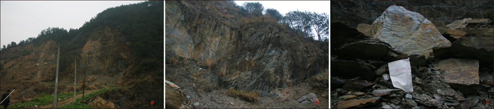
[Figure: The Mukeng Formation in Qimen area, Ahhui Province]
Synonym: (木坑组) ; Mukeng Quartzite, Huansha Fm. The Mukeng Formation was named as "the Huansha Formation" by the Anhui Party of Regional Geological Survey in 1971 (on Guidebook of 1: 200 000 Scale of Geological Map of Qimen Sheet) and was merged into the Mukeng Formation in 1987 (on Regional Geology of Jiangxi Province).
Lithology and Thickness
The Mukeng Fm is composed of a monotonous lithology of greenish gray medium-bedded phyllitic siltstone intercalated with silty phyllite and phyllite. The top part is composed of light red and purple red phyllitic calcareous siltstone, occasionally interbedded with green sandstone. The thickness is more than 4600 m. Southward the black mudstone intercalated between green sandstone is increasing and the thickness becomes less than 3000 m. Northward to the north of Qimen-Tunxi, it changes to unitary greenish gray and greenish yellow meta-siltstone about 1100 to 2600 m thick.
Relationships and Distribution
Lower contact
The Mukeng Fm rests unconformably on the underlying Banqiao Fm of the Shuangjiaoshan Gr, or the Anleling Fm.
Upper contact
It is conformably overlain by the Niuwu Fm (black sandy meta-siltstone).
Regional extent
Southernmost Anhui. Xiuning County, Anhui Province.
GeoJSON
Fossils
Age
Depositional setting
Additional Information